How do almost 25 million people move inside one of the biggest cities in the world?
This research explores the methods in which Mexico’s City population is able to move through the complex spatial organization in the city.
After the end of the Mexican revolution in 1920, the country urged for a reconstruction. With the late and intense arrival of the modern industrialization -which was mainly driven by the nationalization of the oil industry- the population growth in the nation boomed. This condition generated an uncontrolled migration mainly to the capital, the old Federal District.
These influxes, protected under the constitutional law of 1917 - which ensures decent housing for all Mexicans - forced since the early '40s a rapid and uncontrolled expansion of the city’s urban sprawl. T transformed the outskirts into a laboratory -which currently continues- of architectures which experiment with different forms to inhabit and move within the city.
Today, despite some changes in the demographic trends, the suburbs built in the ‘70s and ‘80s continue their conurbation into the political limits of the state of Mexico, extending with them the transportation routes and the distances between the housing developments and the service and manufacturing industrial centers.
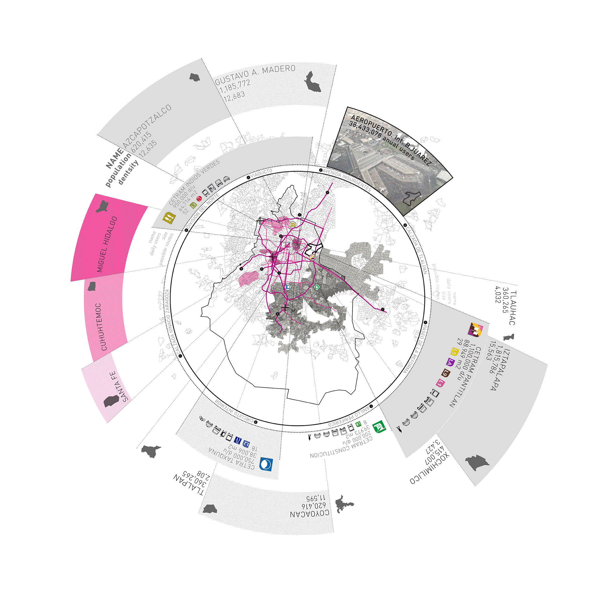
In order to communicate the parts of the city, there are currently several types of public transportation. These operate jointly between the jurisdictions of the Federal District and the State of Mexico. Each system extends into different scales and operates its own routes within the urban sprawl. Within the natural superposition of the different layers and types of transport, there are specific nodes which intercept large population flows
These population flows allowed the insertion of a new building type in the '70s, the centers of multimodal transference (CETRAM for its name in Spanish). Originally they were only a complement to the metro stations. Over time they have become more complex centers capable of distributing millions of people into various types of public transport (RBT, subway, bus routes, taxi, Metrobus, Microbus) throughout the day.
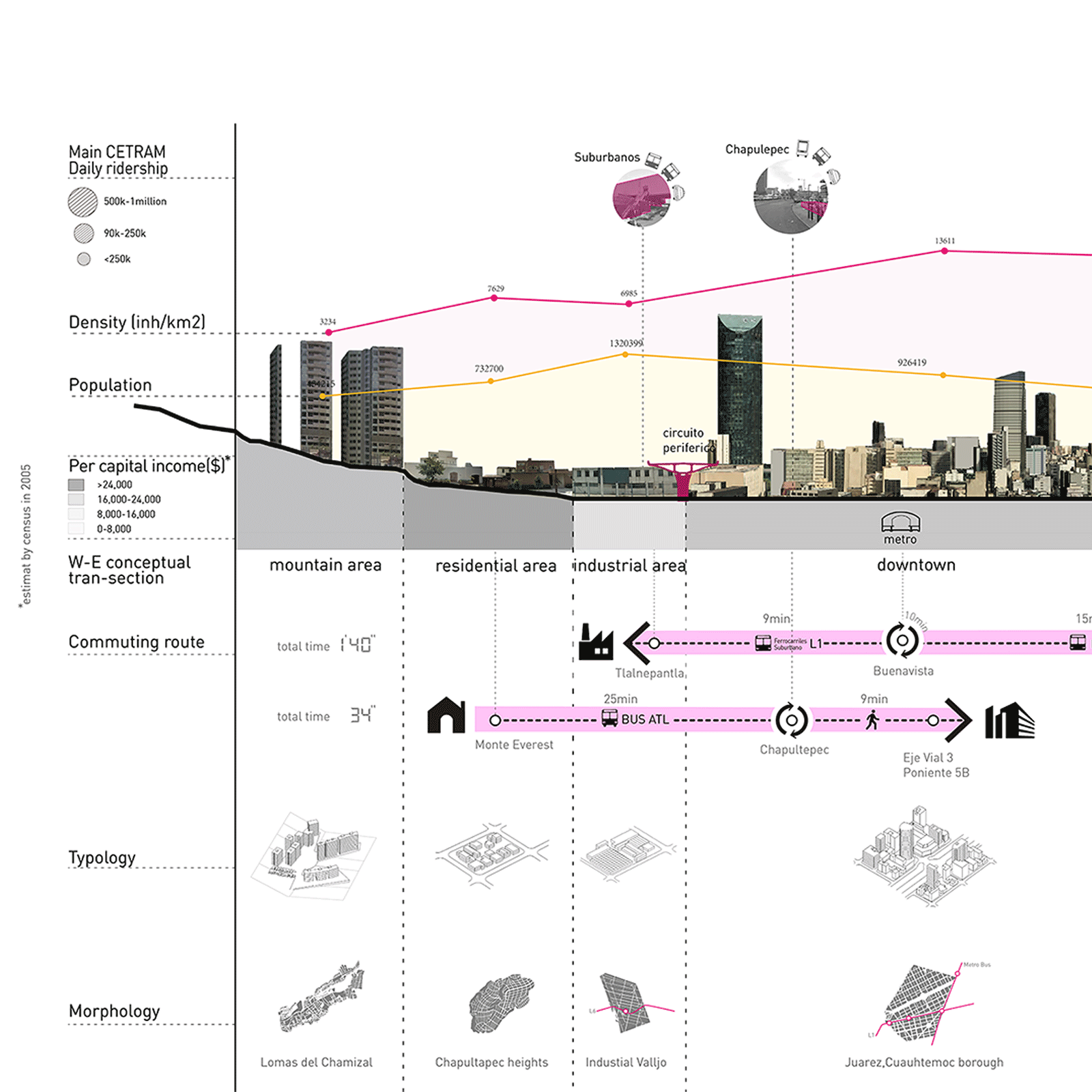
By selecting the CETRAM and the routes with greater ridership intensity, we can track the origin and destinations of the majority of its users. This study is focused on locating and tracking the routes, and the entry and exit points of the population coming from the State of Mexico into the Federal District. By using two routes to split and make a west-east cross-section through the city, the drawing seeks to unveil the urban, architectural, and social context that currently exists on the route.
It should concern architects that for the average resident, his daily commute to work represent an average of 3-4 hours of his daily time.
In Mexico City connectivity is one of the instruments used to reinforce inequality in the population’s spatial distribution. By using this instrument, the market economy ensures that the population with the least access to financed capital pay its "quota" through a transaction that exchanges time for the 'right’ to transit throughout the city.